
Indonesian Parliament Advances Landmark Domestic Worker Protection Bill Amidst Calls for Swift Ratification

Jakarta, CNN Indonesia – In a significant move signaling progress on a long-stalled legislative initiative, the Indonesian House of Representatives (DPR) and the government reached a crucial agreement on Monday evening, April 20, 2020, to expedite the Domestic Worker Protection Bill (RUU PPRT) to a plenary session for ratification into law. This pivotal decision, made during a Level One decision-making meeting at the DPR’s Legislation Body (Baleg), was hailed by advocates as a critical step towards formalizing the rights and protections for millions of vulnerable domestic workers across the archipelago.
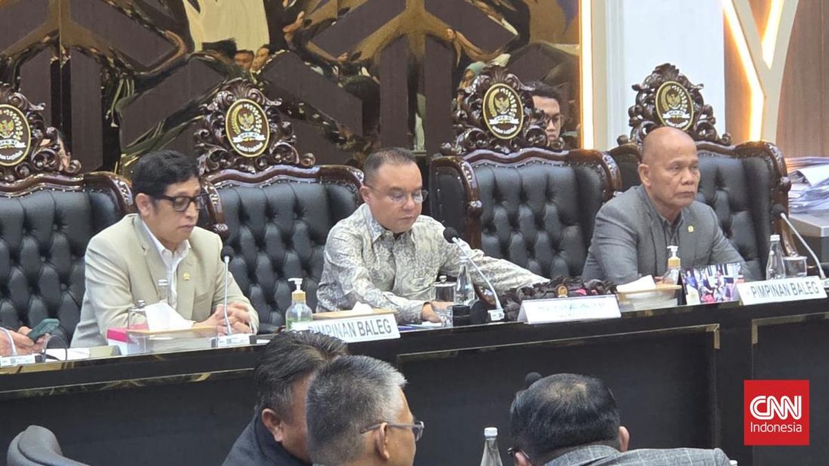
The meeting, presided over by Deputy Speaker of the DPR Sufmi Dasco Ahmad, saw active participation from key cabinet ministers and representatives, underscoring the government’s ostensible commitment to the bill. Among those present were Minister of Law and Human Rights Supratman Andi Agtas, Deputy Minister of State Secretariat Bambang Eko Suhariyanto, and Deputy Minister of Manpower Afriansyah Noor. The unanimous endorsement from all eight attending factions during the preliminary views session underscored a rare convergence of political will, propelling the bill forward with an anticipated agenda for the upcoming plenary session, tentatively scheduled for the very next day, Tuesday, April 21, 2020. This rapid progression marked a dramatic shift after years of legislative inertia, injecting a fresh wave of hope into the protracted struggle for domestic workers’ rights.
A Decades-Long Battle for Recognition and Rights
The journey to enact a comprehensive law protecting domestic workers in Indonesia has been a protracted and arduous one, spanning over two decades. For millions of domestic workers, predominantly women and often internal migrants from rural areas, their labor has historically been relegated to the informal sector, largely unregulated and unacknowledged by specific legal frameworks. This lack of legal recognition has left them acutely vulnerable to exploitation, abuse, low wages, excessive working hours, and the complete absence of social security or formal employment contracts.
Estimates suggest that Indonesia is home to between 4 to 5 million domestic workers, though precise figures are hard to ascertain due to the informal nature of their employment. A significant portion of these workers toil behind closed doors, isolated from public scrutiny, making them susceptible to various forms of mistreatment, including physical, psychological, and sexual abuse, as well as wage theft and forced labor. Human rights organizations and labor unions have consistently documented cases of severe exploitation, highlighting the urgent need for legal safeguards. Before the RUU PPRT, domestic workers were primarily covered by general labor laws or civil codes, which proved inadequate for addressing the unique dynamics of domestic employment, often characterized by power imbalances and a lack of formal oversight.
International pressure has also played a role in pushing for this legislation. The International Labour Organization (ILO) adopted Convention 189 (C189) on Decent Work for Domestic Workers in 2011, setting global standards for their protection. While many countries have ratified and implemented C189, Indonesia’s slow progress on the RUU PPRT has drawn criticism and advocacy from international bodies and local civil society alike, emphasizing the country’s obligation to uphold fundamental human rights and labor standards. The absence of a specific law had been a glaring gap in Indonesia’s legal architecture, leaving a significant segment of its workforce without adequate protection.
The Rapid Progression of April 20, 2020
The "rapid discussion" (pembahasan kilat) that characterized the April 20, 2020, meeting was particularly noteworthy, given the bill’s prior stagnation. The government’s Presidential Letter (Surpres) regarding the RUU PPRT had only been received by the DPR on April 15, 2020. Within just five days, and after merely a single day of formal deliberation between the government and the Baleg’s ad-hoc committee (Panja RUU PPRT), the bill was declared ready for plenary. The televised meeting itself lasted less than three hours, from 1:00 PM WIB.
Bob Hasan, the Chairman of Baleg, reported that the committee had thoroughly addressed 409 items on the List of Inventory Issues (DIMs), comprising 231 permanent DIMs, 55 editorial DIMs, 23 substantive DIMs, and 100 DIMs that were ultimately removed. He affirmed that "all DIMs have essentially been resolved," paving the way for the bill’s advancement. This efficiency, while celebrated by proponents as a sign of renewed political commitment, also raised questions among some observers about the depth of the deliberations, especially for such a complex and long-debated piece of legislation. Nevertheless, the consensus achieved among diverse political factions was undeniable, demonstrating a collective recognition of the bill’s critical importance.
Key Provisions of the Proposed Bill
Chairman Bob Hasan outlined the core components of the RUU PPRT, which comprised 12 chapters and 37 articles. These provisions were designed to fundamentally reshape the relationship between domestic workers and their employers, establishing a framework of rights, obligations, and protective measures. Among the crucial points highlighted were:
- Legal Protection for Domestic Workers: This provision aimed to formally recognize domestic workers as legitimate employees, affording them the same fundamental labor rights as workers in other sectors. It sought to provide a clear legal basis for their employment, moving beyond the informal, unregulated status that had long characterized the sector.
- Recruitment Schemes: The bill proposed regulating the recruitment process, intending to eliminate exploitative practices often perpetrated by informal agencies or individual brokers. It aimed to ensure transparent, fair, and ethical recruitment, preventing debt bondage and human trafficking. This included clear guidelines for agencies involved in mediating domestic worker placements.
- Education and Training: Recognizing the importance of skill development and professionalization, the bill included provisions for education and training programs for domestic workers. These programs would not only enhance their capabilities but also contribute to their dignity and career progression, potentially opening pathways for better wages and working conditions.
- Protection of Rights and Obligations: This was a cornerstone of the bill, stipulating clear rights for domestic workers, such as the right to fair wages, reasonable working hours, weekly rest days, annual leave, and protection from all forms of violence and discrimination. Concurrently, it outlined their obligations, fostering a balanced and respectful employment relationship.
- Social and Health Security: A groundbreaking aspect of the bill was its mandate for domestic workers to be covered by national social security programs, specifically BPJS Kesehatan (health insurance) and BPJS Ketenagakerjaan (employment social security). This provision aimed to provide essential safety nets, ensuring access to healthcare and protection against work-related accidents or old age, a benefit largely inaccessible to them previously.
These provisions collectively represented a paradigm shift, moving from an unregulated, often exploitative environment to one governed by law, dignity, and basic human rights. The bill sought to bring formal structures to a sector that has long operated in the shadows, empowering domestic workers with legal recourse and social safeguards.
Reactions and the Unforeseen Delays
The agreement on April 20, 2020, to advance the RUU PPRT was met with a mix of optimism and cautious anticipation from various stakeholders.
Civil Society and NGOs: Organizations that had tirelessly campaigned for the bill, such as Jaringan Nasional Advokasi Pekerja Rumah Tangga (JALA PRT), Migrant CARE, and Komnas Perempuan (National Commission on Violence Against Women), expressed cautious optimism. They lauded the DPR’s and government’s commitment, recognizing the April 20 decision as a monumental step forward after years of legislative deadlock. However, they also stressed the critical importance of swift ratification and, more importantly, robust implementation. They emphasized that the law’s true impact would depend on effective enforcement mechanisms, public awareness campaigns, and continued monitoring to prevent backsliding or circumvention.
Labor Unions: Labor groups also welcomed the development, viewing it as a vital foundation for improving working conditions for domestic workers. They highlighted the historical injustice faced by this segment of the workforce and saw the bill as an essential tool to ensure their rights are respected, aligning Indonesia with international labor standards.
Government Officials: The government representatives present echoed a commitment to protecting vulnerable workers and fulfilling human rights obligations. They presented the rapid progression as evidence of the administration’s dedication to social justice and the welfare of its citizens.
However, despite the palpable momentum and the hopeful declaration that the plenary session would take place "tomorrow," the RUU PPRT did not, in fact, proceed to a vote in the DPR plenary on April 21, 2020, nor in the immediate months that followed. The "tomorrow" that Deputy Speaker Dasco Ahmad had optimistically alluded to did not materialize for nearly three more years. The bill once again became stalled, a victim of various factors including competing legislative priorities, shifts in political dynamics, the unprecedented challenges posed by the COVID-19 pandemic, and lingering disagreements among different political factions and interest groups over specific clauses. Despite the significant progress made at the Baleg meeting in April 2020, the final legislative hurdle proved too high at that moment, leaving domestic workers in a continued state of legal precarity.
The Eventual Passage and Its Implications (March 2023)
It was not until March 21, 2023, nearly three years after the promising Baleg agreement, that the RUU PPRT was finally passed into law by the DPR in a plenary session. The bill became Law No. 2 of 2023 concerning the Protection of Domestic Workers, marking a truly historic victory for human rights and labor justice in Indonesia after two decades of relentless advocacy.
The eventual enactment of this law carries profound implications for millions of domestic workers and the broader Indonesian society:
- Formal Recognition and Dignity: The law formally recognizes domestic workers as legitimate employees, affording them rights and protections previously denied. This is a monumental step in elevating their status and dignity, shifting perceptions from mere household help to professional laborers.
- Standardized Employment Conditions: The law mandates formal employment contracts, which must clearly stipulate wages, working hours, rest days, and other conditions of employment. This standardization aims to prevent arbitrary practices and provide a legal basis for workers to assert their rights.
- Access to Justice and Dispute Resolution: Crucially, the law establishes mechanisms for dispute resolution, allowing domestic workers to seek legal recourse in cases of exploitation, abuse, or contractual violations. This provides a vital avenue for justice that was largely absent before.
- Social Security Coverage: The inclusion of domestic workers in national social security programs (BPJS Kesehatan and BPJS Ketenagakerjaan) is a transformative provision. It ensures they have access to essential healthcare and protection against work-related risks, old age, and death, providing a much-needed safety net.
- Prevention of Exploitation: By regulating recruitment and employment practices, the law aims to curb human trafficking, debt bondage, and other forms of modern slavery that domestic workers have historically been vulnerable to.
- Challenges in Implementation: Despite its groundbreaking nature, the law’s effectiveness will largely depend on robust implementation. Challenges include:
- Awareness: Ensuring that both domestic workers and employers are fully aware of their rights and obligations under the new law.
- Enforcement: Establishing effective monitoring and enforcement mechanisms across the vast Indonesian archipelago, especially in private homes.
- Cultural Shifts: Overcoming ingrained societal perceptions that often devalue domestic work and resist formalization.
- Budget and Resources: Allocating sufficient government resources for supervision, training, and dispute resolution.
The April 20, 2020, agreement, though followed by significant delays, stands as a critical milestone in the long and arduous journey towards securing justice for Indonesia’s domestic workers. It demonstrated a moment of shared political will that, while not immediately successful in bringing the bill to fruition, laid essential groundwork and reignited hope, ultimately culminating in the historic passage of the Domestic Worker Protection Law in March 2023. This law is not merely a legal document but a beacon of hope for millions, promising a future where their labor is recognized, their rights are protected, and their dignity is upheld.


