Magnitude 7.4 Earthquake Strikes Northern Japan, Triggers Tsunami Warnings Locally While Indonesia Confirms No Threat

A powerful magnitude 7.4 earthquake struck off the coast of northern Japan on Monday, April 20th, triggering immediate tsunami warnings for several prefectures along the Pacific coastline. While the Japan Meteorological Agency (JMA) swiftly issued alerts, including a potential three-meter tsunami for some areas, Indonesia’s Meteorology, Climatology, and Geophysics Agency (BMKG) promptly assured its citizens that the seismic event posed no tsunami threat to the archipelago. The earthquake, which occurred at 16:53 local time (07:53 UTC) in the Pacific Ocean off the coast of Iwate Prefecture, caused significant shaking felt hundreds of kilometers away in Tokyo, underscoring its immense power.
Immediate Response and Tsunami Warnings in Japan
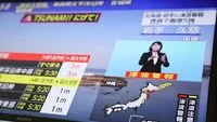
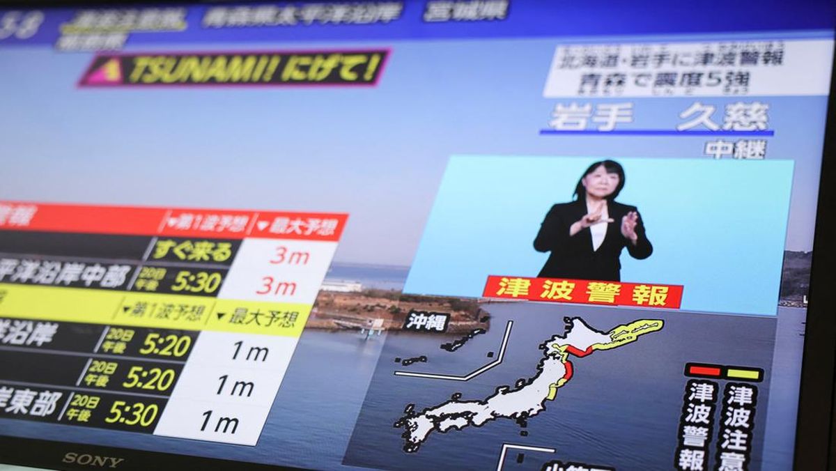
Following the powerful tremor, the Japan Meteorological Agency (JMA) acted with characteristic speed and precision, issuing immediate tsunami warnings and advisories for various coastal regions. The highest level of alert, a "tsunami warning" (津波警報 – tsunami keihō), was initially declared for the central Pacific coast of Hokkaido, the Pacific coast of Aomori Prefecture, and Iwate Prefecture, urging residents in these areas to evacuate to higher ground immediately. This specific warning indicated the potential for waves up to 3 meters (approximately 10 feet) to strike, posing a significant danger to life and property.
Simultaneously, a "tsunami advisory" (津波注意報 – tsunami chūihō) was issued for a broader range of prefectures, including the eastern and western Pacific coasts of Hokkaido, the Sea of Japan coast in Aomori Prefecture, as well as Miyagi and Fukushima prefectures. These advisories typically signify the expectation of smaller tsunami waves, generally up to 1 meter, but still carry the crucial recommendation for people to stay away from the coast and river mouths. The distinction between a warning and an advisory is critical in Japan’s highly refined disaster response protocols, designed to calibrate the urgency and scale of public reaction.
The first tangible evidence of a tsunami was detected shortly after the earthquake. BMKG reported that sea-level sensors registered a tsunami wave of approximately 60 centimeters (about 2 feet) in Miyako, Iwate Prefecture, at 15:30 WIB (Western Indonesia Time), which corresponds to 17:30 JST (Japan Standard Time). While 60 cm might seem modest compared to the initial 3-meter warning, even waves of this height can be extremely dangerous, capable of sweeping people out to sea, overturning boats, and causing significant damage to coastal infrastructure. The rapid detection and reporting highlighted the efficacy of Japan’s extensive network of ocean-bottom sensors and tide gauges.
The sheer force of the magnitude 7.4 quake was evident not only in the tsunami warnings but also in the widespread ground shaking. Residents in distant Tokyo, located several hundred kilometers from the epicenter, reported feeling strong tremors that swayed high-rise buildings. This intensity underscored the shallow depth of the earthquake, which tends to amplify surface shaking. Japanese authorities, including the national broadcaster NHK, immediately switched to emergency programming, providing continuous updates and evacuation instructions in multiple languages, a standard procedure reflecting the nation’s high state of preparedness. Evacuation orders were swiftly disseminated, urging coastal residents to move to designated safe zones on higher ground, with local government officials and emergency services mobilizing to assist vulnerable populations.
Indonesia’s Vigilance: BMKG’s Assessment and Reassurance
While Japan grappled with immediate tsunami threats, the Indonesian Meteorology, Climatology, and Geophysics Agency (BMKG) took proactive steps to assess any potential impact on its vast archipelago. Given Indonesia’s own susceptibility to tsunamis and its critical role in regional warning systems, a rapid evaluation was paramount. Plt. Director of Earthquake and Tsunami BMKG, Rahmat Triyono, confirmed definitively that the M7.4 earthquake off northern Japan posed no threat of a tsunami reaching Indonesian shores.
"Based on the analysis conducted by the Meteorology, Climatology, and Geophysics Agency (BMKG), the earthquake does not have the potential to cause a tsunami in Indonesian territory," Triyono stated in an official release on Monday, April 20th. This reassurance was crucial for communities along Indonesia’s extensive coastline, many of whom live with the constant awareness of tsunami risks due to the country’s location on the "Ring of Fire."
BMKG’s assessment was based on several critical factors. Firstly, the geographical distance between the earthquake’s epicenter near Japan and the Indonesian archipelago is substantial, spanning thousands of kilometers across the Pacific Ocean. Tsunami waves, while powerful, dissipate energy over vast distances, especially across complex ocean bathymetry. Secondly, the specific orientation and mechanism of the fault rupture played a significant role. The earthquake was identified as a shallow thrust fault event resulting from the subduction of the Pacific Plate beneath the Okhotsk Plate. While thrust faults are potent tsunami generators, the geometry of this particular event and the propagation characteristics of the resulting waves meant that the bulk of the tsunami energy would be directed towards Japan’s eastern coast and other parts of the Pacific, rather than across the equator towards Southeast Asia.
Furthermore, Indonesia is primarily exposed to tsunamis generated in the Indian Ocean or by local seismic activity along its own subduction zones. While the Pacific Ocean does pose a tsunami risk to eastern parts of Indonesia, particularly Papua, events originating far north in Japan typically require a much larger magnitude to generate trans-Pacific tsunamis capable of traveling such distances with destructive force. BMKG’s sophisticated modeling and real-time data from a network of sea-level gauges and deep-ocean tsunameters (DART buoys), which are part of the broader Indian Ocean Tsunami Warning and Mitigation System (IOTWMS) and interconnected with Pacific warning centers, allowed for this swift and accurate determination.
Rahmat Triyono further urged coastal communities across Indonesia to remain calm and not to be swayed by unverified information. He affirmed BMKG’s commitment to continuously monitor the situation and to provide updates to stakeholders, media, and the public as needed, underscoring the agency’s dedication to public safety and information dissemination.
Geological Backdrop: Japan’s Tectonic Volatility
Japan is one of the most seismically active countries in the world, a direct consequence of its precarious position atop the Pacific Ring of Fire. This horseshoe-shaped belt around the Pacific Ocean is characterized by intense seismic and volcanic activity, where multiple major tectonic plates converge. In the region of the magnitude 7.4 earthquake, the primary interactions involve the Pacific Plate subducting beneath the Okhotsk Plate (often considered part of the larger North American Plate or Eurasian Plate).
The Pacific Plate, an oceanic plate, is moving westward and diving beneath the Okhotsk Plate along the Japan Trench. This process, known as subduction, is a fundamental mechanism driving some of the Earth’s most powerful earthquakes and generating tsunamis. As the Pacific Plate descends, it drags material from the overlying Okhotsk Plate downwards, building immense stress over time. When this stress overcomes the frictional resistance between the plates, the accumulated energy is suddenly released, causing an earthquake. The specific mechanism identified for this event – a "thrust fault" – is characteristic of subduction zones, where one block of crust is pushed up and over another. This vertical displacement of the seafloor is precisely what can displace vast columns of water and generate tsunamis.
Japan experiences thousands of earthquakes every year, though most are too minor to be felt or cause damage. However, the potential for major, destructive earthquakes and tsunamis is ever-present. The country’s infrastructure, building codes, and public awareness campaigns are among the most stringent globally, a testament to its long history of confronting these natural hazards. The continuous grinding of these massive tectonic plates makes Japan a living laboratory for seismological research and a global leader in earthquake and tsunami preparedness.
The Anatomy of the Quake: Specifics and Science
The M7.4 earthquake’s epicenter was precisely located at coordinates 39.92° North Latitude and 142.88° East Longitude. What was particularly significant was its shallow hypocentral depth of only 10 kilometers (approximately 6 miles). Earthquakes occurring at shallow depths tend to produce more intense ground shaking at the surface compared to deeper quakes of similar magnitude, as the seismic energy has less distance to travel and attenuate. This shallow depth also makes them more efficient at generating tsunamis because the fault rupture directly affects the seafloor, causing maximum displacement of the water column above.
A magnitude 7.4 earthquake is classified as a "major" earthquake, capable of widespread, heavy damage, particularly in populated areas close to the epicenter. While not in the "great" earthquake category (M8.0 and above), an M7.4 event possesses substantial destructive potential. The energy released by an earthquake of this magnitude is equivalent to hundreds of kilotons of TNT, a stark reminder of the immense forces at play within the Earth’s crust. The specific details of the hypocenter and fault mechanism provided by BMKG and JMA are crucial for understanding the immediate hazard and for refining tsunami models.
Historical Context and Lessons Learned: Echoes of the Past
For Japan, every significant earthquake carries the weight of history, particularly the devastating 2011 Great East Japan Earthquake and Tsunami. That magnitude 9.1 event, which struck on March 11, 2011, off the coast of Tohoku, generated tsunami waves that reached up to 40 meters in height, caused widespread destruction, and triggered the Fukushima Daiichi nuclear disaster. The 2011 disaster, which claimed over 15,000 lives and caused unprecedented economic losses, fundamentally reshaped Japan’s approach to disaster preparedness and warning systems.
While the M7.4 earthquake in April 2020 was significantly smaller in magnitude than the 2011 event (a difference of two whole numbers on the logarithmic magnitude scale represents a 1,000-fold difference in energy release), it struck in a geographically similar region and served as a stark reminder of the ever-present threat. The rapid and decisive actions taken by JMA and local authorities in 2020 reflected the profound lessons learned from 2011. Evacuation protocols are now more ingrained, public awareness is heightened, and infrastructure resilience has been significantly upgraded. Coastal defenses have been strengthened, and early warning systems have been continuously refined to provide even quicker and more accurate alerts, giving residents precious minutes to seek safety.
The 2011 event also underscored the importance of not underestimating even seemingly small tsunami waves. Many victims in 2011 died because they did not evacuate after initial, smaller waves arrived, only to be overwhelmed by much larger subsequent waves. This history informs the urgent tone of JMA’s warnings, even for waves like the 60 cm detected in Miyako, emphasizing that even modest initial waves can be precursors to larger ones, or themselves capable of causing harm.
Tsunami Mechanics and Detection
Tsunamis are not typical ocean waves caused by wind; they are long-period ocean waves generated by large-scale disturbances of the seafloor, most commonly by powerful undersea earthquakes that cause vertical displacement. When a thrust fault ruptures and the seafloor suddenly lifts or drops, it displaces the entire water column above it. This displaced water then propagates outwards as a series of waves. In the deep ocean, tsunami waves are barely perceptible, traveling at speeds comparable to a jet airliner (500-1000 km/h) with wave heights of only a few tens of centimeters. However, as these waves approach shallower coastal waters, their speed decreases, but their height dramatically increases, sometimes reaching tens of meters as the wave energy is compressed into a smaller volume of water.
The detection and warning of tsunamis rely on a global network of instruments. Seismic sensors continuously monitor for earthquakes, and if an undersea quake of sufficient magnitude and characteristics occurs, it triggers an initial alert. This is followed by verification from Deep-ocean Assessment and Reporting of Tsunamis (DART) buoys, which consist of a bottom pressure recorder on the seafloor that detects changes in water pressure due to tsunami waves, and a surface buoy that transmits this data via satellite. Coastal tide gauges also measure sea level in real-time. Data from these sources are fed into tsunami warning centers, like the Pacific Tsunami Warning Center (PTWC) and JMA, which use sophisticated models to predict tsunami arrival times and heights for various coastal regions. The speed of information dissemination is critical, as every minute saved can mean lives saved.
Broader Implications and Global Cooperation
The M7.4 earthquake in northern Japan served as another reminder of the relentless geological forces shaping our planet and the continuous challenge of living in highly seismic zones. For Japan, it was a test of its robust disaster preparedness systems, which once again proved effective in issuing timely warnings and facilitating immediate public response. The event underscored the critical importance of a multi-layered approach to disaster risk reduction: from advanced scientific monitoring and early warning systems to resilient infrastructure, comprehensive public education, and well-drilled evacuation procedures.
Beyond Japan, the incident highlighted the interconnectedness of global tsunami warning systems. While Indonesia was not directly threatened, BMKG’s swift analysis and public communication demonstrated the agency’s capability and its contribution to regional safety. International cooperation among tsunami warning centers, facilitated by organizations like UNESCO’s Intergovernmental Oceanographic Commission (IOC), ensures that seismic events anywhere in the Pacific or Indian Oceans are rapidly assessed, and warnings are shared globally, allowing all potentially affected nations to take appropriate action.
Economically, while a M7.4 quake can cause localized damage, Japan’s resilient infrastructure and rapid recovery mechanisms typically mitigate long-term impacts compared to less prepared nations. Socially, such events reinforce the collective memory of past disasters and solidify a culture of preparedness, vigilance, and community solidarity. The constant threat of natural hazards remains a defining characteristic of life in the Pacific Rim, driving continuous innovation in science, engineering, and public policy aimed at minimizing loss of life and property.
In conclusion, the magnitude 7.4 earthquake off northern Japan, occurring on April 20th, successfully activated Japan’s sophisticated tsunami warning system, leading to prompt evacuations and the detection of a 60 cm tsunami wave in Miyako. Simultaneously, Indonesia’s BMKG swiftly and accurately determined that the event posed no tsunami threat to its territory, demonstrating the efficacy of regional and international monitoring efforts. The incident underscored both the persistent geological risks faced by nations in the Pacific Ring of Fire and the paramount importance of advanced scientific understanding, robust early warning systems, and a well-informed public in mitigating the devastating impacts of such natural phenomena. Continuous vigilance and preparedness remain essential for communities worldwide living in the shadow of tectonic activity.