Indonesia Faces Critical Monitoring Gaps Across Its 127 Active Volcanoes Amid Calls for Institutional Overhaul

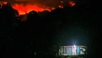
Yogyakarta — Indonesia stands as one of the most volcanically active nations on the planet, cradled within the volatile tectonic intersection known as the Pacific Ring of Fire. Home to a staggering total of 127 active volcanoes distributed across its vast archipelago, the country faces a permanent, high-stakes challenge in disaster risk reduction. However, a stark disparity plagues the nation’s volcanic hazard infrastructure: despite the sheer volume of threats, only a single monitoring facility—Mount Merapi in Central Java and the Special Region of Yogyakarta—is currently equipped with comprehensive, cutting-edge technology.
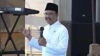
This critical vulnerability in the country’s disaster mitigation architecture was brought to the forefront during a recent academic discussion held at Universitas Gadjah Mada (UGM) in Sleman, Yogyakarta. Leading volcanologists and former disaster management officials gathered to dissect the state of Indonesia’s volcano monitoring systems, warning that current structural limitations, funding shortfalls, and institutional fragmentation severely hamper the nation’s ability to issue rapid and reliable early warnings for remote populations.
Categorizing the Threat: The Burden of Type A Volcanoes
To understand the magnitude of Indonesia’s volcanic oversight challenge, experts point to the classification system enforced by the Center for Volcanology and Geological Hazard Mitigation (PVMBG), a specialized unit operating under the Geological Agency of the Ministry of Energy and Mineral Resources (ESDM).
Active volcanoes in Indonesia are officially segregated into three distinct categories. Regulatory and monitoring efforts are predominantly funneled toward Type A volcanoes—defined as active volcanic systems that possess a documented historical record of magmatic eruptions dating back at least to the year 1600. According to official data compiled by the Geological Agency, approximately 76 out of the total 127 active volcanoes fall squarely into this high-risk Tipe A classification.
Monitoring these towering natural hazards requires an intricate web of seismic sensors, gas-detection units, tiltmeters, and visual surveillance posts. Yet, according to Agung Harijoko, a prominent volcanologist from the Faculty of Geography at UGM, the distribution of these resources is profoundly uneven.
"In terms of quantity and observation posts, the facilities still vary wildly," Agung explained during the UGM seminar. "Because the most complete setup exists solely on Mount Merapi. Mount Merapi boasts the most comprehensive observations and the finest technology available."
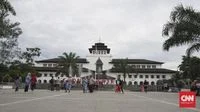
For other active volcanoes scattered across remote islands and isolated terrain, the mitigation strategy relies heavily on scattered geophysical stations. These remote posts feed data back to the central PVMBG headquarters in Bandung, West Java, which subsequently disseminates alerts and activity updates to the public via official communication channels and social media.
The Baseline Limitations of Early Warning Systems
At its core, an effective Early Warning System (EWS) for volcanic activity relies on real-time data acquisition. Volcanic seismicity serves as the primary heartbeat and indicator of unrest, signaling magma movement, fluid pressure changes, and impending structural failures beneath the surface.
While acknowledging that monitoring posts situated in outlying regions are functional, Agung noted that their capabilities remain fundamentally basic. "If you ask whether these posts are proper, yes, they are proper. But they remain limited primarily to seismometers, which is indeed the most crucial element. Observation and seismic posts already exist because seismicity is the core indicator of an active volcano," he stated.
Nevertheless, a dangerous information gap often persists between high-tech central hubs and vulnerable local communities. Because remote observation posts must relay their monitoring metrics back through bureaucratic channels to PVMBG in Bandung before broad warnings are formalized, local populations situated directly on the flanks of distant volcanoes may experience delayed awareness.
"Communities living around volcanic peaks in remote areas might not immediately receive direct information unless they possess active access to PVMBG’s official data streams. Therefore, communication remains paramount," Agung warned.
Institutional Constraints and the Budgetary Dilemma
The conversation surrounding volcanic surveillance quickly expanded from technical hardware to structural governance, drawing sharp critique from former Meteorology, Climatology, and Geophysical Agency (BMKG) Chief Dwikorita Karnawati.
Dwikorita, a distinguished Professor of Environmental Geology and Disaster Mitigation who also served as UGM’s former rector, argued that the uneven distribution of monitoring facilities is directly tied to systemic budgetary constraints and institutional ranking. Currently, the PVMBG operates as a second-tier echelon (eselon II) unit nested within the broader Ministry of Energy and Mineral Resources.
According to Dwikorita, this bureaucratic positioning severely marginalizes disaster mitigation funding, especially when competing against heavyweights within a ministry primarily tasked with managing national energy and mineral resources.
"Consequently, it loses out, making disaster management the lowest priority. The budget is insufficient, even though volcanoes are becoming increasingly active and their numbers are vast. They require technology that is truly commensurate with the challenges they face," Dwikorita asserted.
She pointed to historical precedent to illustrate how institutional elevation can transform national hazard response capabilities. During the administration of President Megawati Soekarnoputri, the institutional status of the BMKG was elevated from an echelon II/I unit into a full-fledged independent government agency. This strategic legal elevation granted the agency the budgetary autonomy and legal authority necessary to expand its observation networks in lockstep with technological demands.
The Case for Institutional Integration: Learning from Japan
Drawing from her extensive tenure leading the BMKG, Dwikorita reignited a controversial institutional reform proposal that she first advanced in 2019 and reiterated in 2023: integrating the functions of the PVMBG directly into the BMKG framework.
Rather than incorporating the entirety of the Geological Agency—which oversees vast, non-hazard-related sectors such as groundwater management, marine geology, mineralogy, and energy resources—Dwikorita advocates for carving out the volcanic and geological disaster mitigation units and housing them under the BMKG umbrella as an echelon I deputy directorate.
She argued that keeping volcanic monitoring separate from the agency tasked with broad atmospheric and geophysical early warnings creates dangerous institutional friction. "Our past experience taught us that we could not issue timely early warnings because all monitoring facilities and equipment resided within the Center for Volcanology, while the mandate for public early warning rested with us," she recalled. "As a result, we could not perform the necessary analyses or calculations independently. That is why the proposal was raised."
Dwikorita cited the structural model employed by the Japan Meteorological Agency (JMA) as a global benchmark for efficient disaster response. In Japan, meteorological phenomena, tsunamis, and volcanic eruptions are consolidated under a single, unified institutional umbrella. This seamless integration ensures that when a volcanic flank collapses or a submarine eruption triggers seismic anomalies, data streams instantaneously into a unified analytical engine, drastically accelerating response times and public evacuation orders.
Furthermore, Dwikorita emphasized that retaining the status quo invites bureaucratic duplication. The operational workflows of the PVMBG in monitoring seismic hazards closely mirror the seismic monitoring networks already operated by the BMKG.
"If the entire scope of the Geological Agency were absorbed into the BMKG, the BMKG would lose sight of its primary mission and get bogged down managing unrelated matters," she explained. "Therefore, simply extract the components concerning disasters and disaster mitigation. In reality, if we study it closely, the functions performed by the PVMBG are identical to those within the BMKG. Isn’t that a duplication of duties?"
Implications for National Resilience
As Indonesia navigates an era marked by shifting climatic patterns and unpredictable geological activity, the debate over how to modernize and unify the nation’s volcanic hazard infrastructure takes on profound urgency. With 76 Type A volcanoes capable of catastrophic eruptions at any given moment, experts agree that relying on fragmented funding streams and compartmentalized communication lines poses an unacceptable risk to millions of citizens residing in high-risk shadow zones.
Whether the government ultimately chooses to restructure institutional hierarchies, elevate budgetary support for the Ministry of Energy and Mineral Resources, or pursue structural integration along the lines of international models like Japan’s JMA, the consensus among scientific experts remains clear: Indonesia’s world-class volcanic threat demands a world-class, unified, and fully funded technological shield.