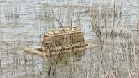
The dramatic retreat of water levels at the Waduk Gajah Mungkur reservoir in Wonogiri, Central Java, has once again unveiled a haunting remnant of the region’s submerged history: dozens of ancient tombs sitting squarely on the cracked, dry lakebed. As the prolonged dry season tightens its grip on the area, the stark visibility of these historical graves serves as a physical reminder of the sweeping landscape transformations that occurred decades ago to make way for one of Indonesia’s major water infrastructure projects.
While the full extent of the cemetery remains partially submerged beneath the receding yet still substantial water mass, the portions that have breached the surface offer a poignant glimpse into the past. Local residents and officials confirm that this recurring phenomenon acts as an annual historical marker, bridging the gap between modern water resource management and the deep-rooted personal histories of families displaced generations ago.
The Geography and Current State of the Exposed Tombs
The exposed graves are primarily concentrated in the Wuryantoro sub-district, within the administrative boundaries of Wuryantoro Subdistrict and Village in Wonogiri Regency. According to local witnesses, the tombs began breaking the water line over the course of several days as the intense sun and lack of rainfall accelerated evaporation and water withdrawal.
Karni, a local resident residing near the reservoir, noted that the uncovering process is still in its preliminary stages. While a cluster of graves is now clearly visible across the dried silt and clay of the reservoir floor, a far greater number remains hidden beneath the murky water.
The physical condition of the revealed tombs varies significantly. Some grave markers remain remarkably intact, while others show profound signs of erosion, weathered down by decades of water immersion, shifting sediment, and biological activity. A portion of these structures appears to have been constructed using limestone, a common local building material of past eras. The headstones, or nisan, display diverse dimensions, ranging from compact markers roughly half a meter in length to larger structures spanning up to two meters. Weathered inscriptions and hand-carved motifs are still faintly visible on select markers, though the relentless passage of time and water erosion have rendered most details illegible to the untrained eye.
A Predictable Annual Phenomenon With a Slower Timeline
The reappearance of the Wuryantoro tombs is not an unprecedented event or a sudden archaeological discovery; rather, it is a well-documented seasonal occurrence. Whenever severe dry spells hit the Wonogiri region and reduce the volume of Waduk Gajah Mungkur, the topography of the pre-flooding landscape inevitably resurfaces.
Soemardjono Fadjari, the Camat (Head) of Wuryantoro, explained that the emergence of these burial sites happens almost every year. However, the exact timing and scale of the exposure depend entirely on meteorological patterns and the rate of water depletion.
"Every dry season, these graves usually begin to show, but right now it is only partial because the water level is still quite high," Soemardjono stated.
In a typical hydrological cycle, the reservoir’s drawdown becomes pronounced enough to expose the graves as early as August. For the current year, however, the process has faced a slight delay. The reservoir’s slow rate of water recession pushed the initial visibility of the tombs into September, leaving a significant portion of the historical site still submerged under shallow water.
Despite the intrinsic historical and emotional value of the site, it has not evolved into a commercial tourist hotspot. Local observations indicate that the area experiences very modest foot traffic. The rare visitor who ventures close to the site generally consists of curious individuals capturing photographs on their mobile phones, rather than organized tour groups. The majority of people frequenting the exposed basin are local fishermen utilizing the receding shoreline or farmers checking on adjacent agricultural plots that benefit from the fertile, albeit shifting, soils near the reservoir’s edge.
Accessing the site presents notable physical challenges. Visitors cannot simply walk up to the graves on paved pathways; instead, they must navigate the rugged, uneven terrain of the dried reservoir floor. The ground consists of dense, cracking mud that remains damp and slippery in deeper pockets, making the trek across the exposed lakebed both arduous and hazardous.
The Historical Context: A Submerged Landscape and Mass Resettlement
To understand why cemeteries rest at the bottom of Waduk Gajah Mungkur, one must look back at the monumental engineering and social upheaval of the late 1970s and early 1980s. The construction of the reservoir was a massive state undertaking designed to tame the unruly flow of the Solo River, control catastrophic downstream flooding, generate hydroelectric power, and provide a reliable irrigation network for the agricultural heartlands of Central and East Java.
However, realizing these developmental goals required a staggering human and geographical cost. The creation of the sprawling artificial lake necessitated the systematic inundation of vast residential areas, productive agricultural lands, and community infrastructure. Historical records indicate that the dam project impacted an immense area, resulting in the submersion of 51 villages spread across seven distinct sub-districts within Wonogiri Regency.
Thousands of families were forced to pack up their belongings, abandon their ancestral homes, and participate in massive government-sponsored transmigration programs or relocate to higher ground surrounding the planned reservoir boundary. Whole communities—complete with their homes, places of worship, communal spaces, and public cemeteries—were permanently swallowed by the rising waters once the dam gates were closed.
For the families whose ancestors were interred in these flooded burial grounds, the seasonal retreat of the water carries a complex mix of sorrow, nostalgia, and closure. While relocation committees made extensive efforts to move as many graves as possible prior to the final flooding, logistical constraints, rapid inundation schedules, and undocumented or forgotten burial plots meant that numerous tombs were left behind. Consequently, the temporary exposure of these graves during severe droughts serves as an annual, bittersweet reunion for the descendants of those displaced communities, bringing long-submerged family histories back into the light of day.
Broader Implications: Water Management, Climate Variability, and Heritage Preservation
The recurring exposure of the Wuryantoro tombs highlights several contemporary issues facing Central Java, ranging from water resource management to the visible impacts of climate variability.
From a hydrological perspective, the delayed and fluctuating water levels in Waduk Gajah Mungkur reflect the increasingly unpredictable nature of Indonesia’s wet and dry seasons. Meteorological shifts, influenced by broader global climate phenomena such as El Niño and La Niña, frequently alter precipitation patterns across Java. When the dry season intensifies or extends past its historical parameters, reservoirs crucial for municipal water supply and agricultural irrigation experience critical drops in volume. While this depletion aids local farmers by exposing temporary arable land along the receding shores, it simultaneously raises concerns among water authorities regarding regional drought resilience and water security.
Furthermore, the surfacing of historical artifacts and cemeteries prompts discussions regarding heritage management in areas affected by major infrastructure projects. While the submerged graves are primarily a local matter tied to personal genealogy rather than internationally recognized archaeological treasures, they represent an essential component of intangible cultural heritage and local identity. The emotional resonance of these sites underscores the importance of documenting and preserving the oral histories of communities displaced by major public works before the older generations pass away.
As long as seasonal droughts continue to cycle through Wonogiri, Waduk Gajah Mungkur will periodically pull back its aquatic curtain, offering a transient glimpse into the world that existed before the dam. These ancient graves, standing weathered and silent amidst the cracked earth, will continue to serve as a powerful testament to the resilience of local memory and the enduring ties between communities and their ancestral soil.
Related posts: