Comprehensive Emergency Response Underway as Over Four Thousand Hectares of Forest and Land Fires Ravage Multiple Indonesian Provinces

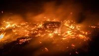
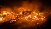
The ongoing battle against severe forest and land fires, locally known as karhutla, continues to escalate across multiple strategic regions in Indonesia. National disaster management authorities have confirmed that thousands of hectares of land and forest across both Kalimantan and Sumatra remain actively ablaze, prompting a massive, multi-agency deployment of personnel, specialized equipment, and advanced atmospheric interventions. Despite round-the-clock efforts by government task forces, regional agencies, military elements, and local volunteers, stubborn hotspots persist, particularly in carbon-rich peatland ecosystems that pose unique containment challenges.
The crisis highlights the recurring vulnerability of Indonesia’s tropical landscape during prolonged dry spells. As environmental conditions exacerbate the risk of ignition and rapid spread, federal and regional bodies have stepped up coordination to suppress active flames, prevent further ecological degradation, and mitigate the public health hazards associated with thick regional haze.
Current Scale of Devastation and Regional Breakdown
Recent figures compiled by the National Disaster Management Agency (BNPB) indicate that more than 3,000 hectares of land and forest across three key provinces in Kalimantan are currently impacted by active fires. The estimated aggregate area undergoing active suppression measures in the Kalimantan region spans approximately 3,392 hectares. Central Kalimantan bears the heaviest burden, accounting for approximately 2,458 hectares of burning terrain. Meanwhile, West Kalimantan reports roughly 884 hectares affected, and South Kalimantan records approximately 52 hectares under active intervention.
Across the Sunda Strait, the island of Sumatra faces a parallel crisis. BNPB monitoring data reveals that approximately 990 hectares of land across three Sumatran provinces have suffered from similar environmental disruptions. South Sumatra represents the largest affected zone on the island, with roughly 889 hectares experiencing fires. Jambi follows with approximately 89 hectares, while Lampung has recorded about 12 hectares impacted within the ecologically sensitive boundaries of the Way Kambas National Works and Conservation area. Notably, Riau province has reported no active, uncontained forest and land fires during this recent monitoring cycle, reflecting successful localized containment or shifting weather patterns.
Further west, the island of Java has not remained entirely unscathed. Fire suppression teams have been forced to mobilize in East Java, specifically targeting localized flare-ups within the ecologically vital Arjuno-Welirang mountain complex. The persistence of fires across multiple distant islands underscores the nationwide scale of the current dry-season emergency.
Multi-Pragmatic Ground and Aerial Suppression Operations
Faced with challenging terrain, deep peat layers, and often inaccessible forest interiors, disaster mitigation authorities have adopted a dual-pronged operational strategy involving coordinated ground forces and sophisticated aerial assets.
On the ground, an extensive network of personnel has been mobilized under the direct supervision of Provincial Command Posts. A staggering total of 57,050 ground personnel have been placed on high alert across six primary provinces. Central Kalimantan leads the deployment with 16,387 personnel stationed in high-risk sectors. West Kalimantan maintains 14,458 personnel on the ground, while South Sumatra deploys 12,285 workers. South Kalimantan operates with 7,927 personnel, Jambi maintains 5,984, and Lampung deploys a specialized localized task force of nine personnel tailored to its concentrated protected area challenges.
According to Berton SP Panjaitan, Acting Head of the BNPB Center for Data, Information, and Communication Disaster, these ground units are fully equipped with specialized tactical gear designed for forestry firefighting. "Suppression efforts are supported by a wide array of equipment, including delivery hoses, suction hoses, nozzles, heavy-duty safety boots, portable pumps, backpack pumps, fire-swatters, and tactical radio communication devices," Panjaitan noted in an official statement.
In the skies, air mobility remains a cornerstone of the containment strategy. A formidable fleet consisting of 61 aerial units has been deployed nationally. This fleet includes 24 aircraft dedicated to aerial reconnaissance, patrol missions, CASA utility flights, and weather modification operations, alongside 37 heavy-duty water-bombing helicopters designed to deliver massive payloads of water directly onto inaccessible hotspots.
Advanced Weather Modification and Scientific Interventions
Beyond direct water application and manual fire-beating, authorities are heavily relying on atmospheric science to alter weather patterns and induce rainfall over drought-stricken regions. Operation Weather Modification (OMC), often referred to as cloud seeding, has been deployed systematically across high-risk zones.
Data detailing operations from late October highlights the sheer scale of these meteorological interventions. In a single day of coordinated flights, 15 individual sorties were executed, dispersing a massive 14,300 kilograms of seeding materials into prospective cloud formations.
In Central Kalimantan, weather modification teams conducted eight sorties, utilizing 7,200 kilograms of specialized seeding agents. This total comprised 5,200 kilograms of dry ice and 2,000 kilograms of sodium chloride (NaCl). While the immediate target areas awaited sustained rainfall, the scientific adjustments aimed to build atmospheric moisture convergence. Similarly, in South Sumatra, seven sortie missions were flown, dispersing 7,100 kilograms of seeding materials. Observers noted that these targeted atmospheric interventions successfully contributed to improved visibility and lowered ambient temperatures by midday, aiding ground crews.
Success stories were also recorded in West Kalimantan, where targeted cloud-seeding operations covered high-risk districts including Sekadau, Ketapang, and Sintang. Subsequent meteorological reports confirmed that light to moderate rainfall fell across seven districts, directly reaching three primary targeted intervention zones. In South Kalimantan, parallel precipitation events were reported in Kotabaru Regency, validating the efficacy of the customized atmospheric strategies, which are continuously adjusted to align with real-time barometric pressures and regional moisture demands.
Complex Challenges in Protected Ecosystems and Peatlands
Fighting fires in tropical peatland regions presents unique, compounding difficulties that differentiate forest fires from standard structural blazes. Peatlands store massive amounts of carbon underground in dense layers of partially decayed organic matter. When surface fires ignite, they often burn underground, smoldering stealthily through the peat layers long after visible surface flames have been extinguished.
This complex phenomenon was clearly evident during suppression operations in the Way Kambas National Park located in East Lampung. Despite aggressive interventions, monitoring units recorded 34 persistent hotspots affecting approximately 16 hectares of protected terrain that remained unextinguished.
To combat hidden underground fires, specialized tactical units deployed thermal drones alongside ground observation posts. These thermal imaging technologies allow firefighting teams to pinpoint subterranean heat signatures and hidden embers buried deep within the peat. Once identified, crews utilize portable high-pressure pumps and extended hose installations stretching nearly three kilometers to deliver pressurized water directly into critical hotspots, saturating the combustible peat layers and preventing reignition.
Chronology and Context of the 2026 Dry Season Crisis
The escalation of forest and land fires is intimately tied to regional climatic cycles. The 2026 dry season brought prolonged periods of low precipitation across key agricultural and forested belts in Indonesia, significantly drying out vegetative cover and lowering the water tables in vital peatland basins.
As early as late September, satellite monitoring systems registered a sharp uptick in hotspot density across the islands of Kalimantan and Sumatra. By mid-October, the accumulation of smoke and haze prompted regional health advisories and led provincial governments to declare emergency alert statuses. This prompted the central government through BNPB to scale up from localized responses to a unified national command structure.
The deployment of dry ice in weather modification represents an evolution in Indonesia’s disaster management toolkit. Unlike traditional salt-based cloud seeding that requires existing moisture-laden cumulus clouds, dry ice techniques can actively encourage condensation and cloud development under specific thermodynamic conditions, providing emergency teams with greater tactical flexibility during prolonged droughts.
Broader Implications, Environmental Impact, and Economic Risks
The persistence of widespread forest and land fires carries profound implications for ecological stability, public health, and the national economy. Environmentally, the combustion of carbon-dense tropical rainforests and peatlands releases massive quantities of greenhouse gases into the atmosphere, temporarily elevating national carbon emission metrics and contributing to global climate forcing. Furthermore, these fires threaten critical biodiversity corridors, destroying the natural habitats of endangered species such as orangutans, Sumatran tigers, and local endemic flora.
From a public health perspective, the drift of smoke and haze across provincial boundaries poses severe respiratory risks to millions of citizens. Reduced visibility frequently disrupts regional aviation networks, forcing the cancellation or delay of commercial flights at domestic airports across Kalimantan and Sumatra. Economically, prolonged disruptions affect local productivity, agricultural supply chains, and tourism sectors, requiring substantial fiscal allocations from both regional and national budgets for emergency response, healthcare support, and subsequent ecological restoration.
Ongoing Vigilance and Future Preparedness
As response teams maintain their rigorous posture across the affected archipelagos, disaster management officials emphasize the critical need for cross-sectoral collaboration. Local communities, plantation operators, and regional governments have been repeatedly cautioned to maintain strict fire-prevention protocols and avoid agricultural burning practices that serve as primary ignition sources.
The integration of advanced technology—ranging from thermal imaging drones and real-time satellite hotspot tracking to scientific weather modification—demonstrates a maturing institutional approach to managing climate-induced hazards in Indonesia. Nevertheless, the sheer scale of the 3,000-plus hectare footprint serves as a sobering reminder of the vulnerability of tropical ecosystems to changing weather extremes. Continued vigilance, sustained funding for localized firefighting infrastructure, and proactive environmental management will remain paramount as authorities work to fully extinguish the remaining active fires and restore ecological equilibrium across the nation.