China Revolutionizes Mineral Exploration With AI Systems That Cut Geological Analysis Time From Months to One Week

The landscape of global mineral exploration is undergoing a seismic shift as China officially unveils two groundbreaking artificial intelligence systems designed to accelerate the discovery of critical resources. During the 28th China Mining Conference and Exhibition held in Tianjin, the China Geological Survey (CGS), operating under the Ministry of Natural Resources, introduced AI-GeoMapping and AI-OreSeeking. These platforms represent a significant technological leap, promising to reduce the timeframe for identifying high-potential mineral zones from the traditional six-month cycle to a mere seven days.
As the global demand for minerals essential to the green energy transition—such as lithium, cobalt, and nickel—continues to soar, the ability to pinpoint deposits with speed and precision has become a strategic priority. China’s deployment of these AI tools signals an era where high-performance computing, deep learning, and vast geological datasets converge to redefine the efficiency of the mining industry.
The Technological Architecture of AI-GeoMapping and AI-OreSeeking
The two systems function as distinct but complementary engines of geological intelligence. AI-GeoMapping is primarily focused on the macro scale, serving as a comprehensive tool for regional geological mapping. By integrating "big data" frameworks with satellite imagery, aerial surveys, and terrestrial surface data, it automates the most labor-intensive aspects of cartography.
According to technical specifications released at the Tianjin conference, AI-GeoMapping streamlines the entire workflow from initial data ingestion to the final drafting of geological maps. The system boasts an overall identification accuracy exceeding 90%, representing a massive increase in productivity. By automating the synthesis of disparate spatial datasets, the system improves the efficiency of data processing and map compilation by more than 50% compared to conventional manual methods.
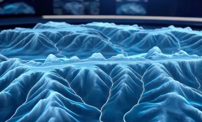
Conversely, AI-OreSeeking serves as a specialized tool for target generation. It is designed to navigate the "needle in a haystack" problem inherent in mineral exploration. The system utilizes a sophisticated architecture that combines traditional geoscience knowledge, standardized exploration models, and over 200 proprietary algorithms. It ingests a massive array of geophysical and geochemical data, including gravimetric, magnetic, electromagnetic, and remote sensing information. By processing this multidimensional data, AI-OreSeeking can generate three-dimensional structural models of the subsurface, predict potential mineral concentrations, and produce automated evaluation reports that guide human decision-making.
Chronology and Operational Testing
The development of these systems did not occur in a vacuum; it is the culmination of years of integrated research within China’s national scientific infrastructure. While the formal launch took place in Tianjin, the systems have been in a "stealth" testing phase for an extended period.
CGS officials confirmed that the AI platforms have been deployed across more than 100 pilot projects spanning ten provinces. In a notable field test conducted in the western Qinling region, AI-OreSeeking was tasked with analyzing 32 standard 1:50,000 scale geological maps. The system completed the complex analysis in five days, identifying two primary exploration targets and four secondary zones of interest. This real-world application underscored the potential for the software to move from theoretical data processing to actionable industrial intelligence.
Furthermore, the reach of AI-GeoMapping has extended beyond China’s borders. The system has been utilized to process nearly 100 map sheets across various regions, with international collaborations already underway in countries including Morocco, Saudi Arabia, and Laos. This international footprint suggests that China intends to export its mineral exploration expertise, potentially setting a new global standard for how geological surveys are conducted in emerging markets.
Implications for the Global Mining Industry
The introduction of these tools carries profound implications for the global mining sector. Traditionally, mineral exploration is a high-risk, high-cost, and time-consuming endeavor. Companies often spend millions of dollars and several years conducting seismic surveys and exploratory drilling only to find that a site does not meet commercial viability.
By utilizing AI to filter out unproductive areas before a single drill bit touches the earth, mining firms can significantly optimize their capital expenditure. The ability to compress a six-month analysis period into a single week is not merely an improvement in speed; it is an improvement in capital efficiency that could lower the entry barrier for exploration projects in previously overlooked or geographically challenging regions.
Furthermore, the list of minerals targeted by these systems—which includes iron, copper, aluminum, lithium, cobalt, nickel, lead, zinc, chromium, potassium, and uranium—directly maps onto the primary components required for the global transition to renewable energy and battery storage technologies. As nations scramble to secure supply chains for these critical materials, the advantage provided by AI-driven predictive modeling could become a decisive factor in the geopolitical struggle for resource security.
Human-AI Collaboration and Ethical Governance
Despite the power of these systems, the China Geological Survey has emphasized that the technology is not designed to replace human geologists. The systems operate on a tiered interface that allows for three distinct modes of interaction: "Expert-Led," "Fully Automated," and "Human-AI Collaborative."
In the Expert-Led mode, the AI acts as a sophisticated assistant, providing data visualizations and calculations based on parameters set by a senior geologist. In the Collaborative mode, the AI and human experts engage in a feedback loop, refining the search parameters based on the system’s initial output. This ensures that the intuitive experience and field expertise of veteran geologists remain the final arbiter of exploration decisions.
This human-centric approach is vital because AI models, while efficient at identifying patterns, remain susceptible to data bias. Geological formations are notoriously complex and often defy standardized categorization. Therefore, while AI can identify high-probability zones, the final decision to commit resources to physical drilling must remain a human responsibility. Verification through in-situ field work remains the indispensable "ground truth" that AI cannot yet bypass.
The Future of Geological Data Science
The development of AI-GeoMapping and AI-OreSeeking highlights a broader trend: the transition of geology from an observational, field-based science to a data-intensive, predictive one. As AI begins to "read" geological patterns with greater clarity than human eyes, the speed of discovery will inevitably accelerate.
However, this transition also brings new challenges. The reliance on algorithmic prediction requires high-quality, standardized data. If the input data—ranging from satellite images to geochemical assays—is fragmented or biased, the output of the AI will be compromised. As such, the next phase of this technological evolution will likely focus on the digitization of global geological archives and the standardization of data collection practices to ensure that these AI systems can function effectively across different regional contexts.
The move by China’s Ministry of Natural Resources reflects a broader national strategy to lead in the digital transformation of natural resource management. By digitizing the very process of discovery, China is positioning itself not only as a major producer of minerals but as a major producer of the "intelligence" that governs how those minerals are found. As these systems move from pilot projects to widespread deployment, the global mining industry will likely be forced to adopt similar AI-driven methodologies to remain competitive, signaling a permanent change in how humanity searches for the resources buried beneath the Earth’s crust.
In conclusion, while the verification of mineral reserves will always require physical exploration, the path to identifying those reserves has been fundamentally shortened. With the ability to process massive, multi-source data in real-time, AI-OreSeeking and AI-GeoMapping are poised to become essential tools for any nation looking to secure its mineral future in an increasingly resource-constrained world.